.png)


Heath and Regeneration
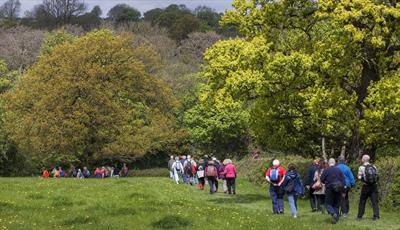
Type:Walking Event
Church Lane
Heath
Chesterfield
Derbyshire
S44 5SD
Call direct on:
Tel01246 345777


About
This walk follows field paths leading to the Stockley trail then south to an area of amazing regeneration. A woodland route leads to another ancient Church & Hardwick Park, field paths are then used for the return to Heath passing through the hamlet of Aswith.
Starting at Heath Church, field paths are used to reach the easy walking Stockley Trail. Here we turn south following the trail to reach the area once used by the now defunct Bramley Vale, (drift mine) and Glapwell Pit. Mining ceased here in 1974 and left an unsightly desolate area including the remains of the tips. Extensive work has since been carried out to reclaim the area, mainly for recreation, enjoyment and nature including planting of trees and the creating of trails.
Leaving this area behind, the walk then climbs gently though extensive woodland to emerge on the raised land on which the ancient church of Ault Hucknal stands in what is thought to be the smallest village in England. In old English it is referred to as Hucca’s nook of land.
From here the route takes us through Hardwick Park with some excellent views of both the Halls. Leaving the path, we head west towards Hardstoft before turning north towards the delightful hamlet of Astwith with perhaps the best view of all of the Halls of Hardwick. We then continue the journey north across open farmland to return to Heath.
Booking essential
Find us on whatthreewords - ///chestnuts.duration.suitable
Grid reference – SK 44818 67080
This is a circular walk
Bring a packed lunch
Organised by CNEDRA Chesterfield and North East Derbyshire Ramblers Association
Guide Prices
Booking essential. Free of charge, however, donations to the Mountain Rescue and Air Ambulance gratefully received.
Facilities
Children
- Children welcome - Children under 16 must be accompanied by an adult, not recommended for children under 11.
Parking
- Free Parking
Property Facilities
- Dogs Accepted - Dogs must be on a lead
- Public toilets - Toilets available at some point on route
Routes
- Accessibility of route - Moderate
- Description of route - Circular walk, 11+ stiles, 3 rest stops, bring a packed lunch
- Length of route (miles) - 9.4 miles
- Typical duration of route - 5½ hours
Opening Times
| Season (16 May 2024) | ||
|---|---|---|
| Day | Times | |
| Thursday | 10:00 | |
* Walks will start promptly.
Map & Directions
Public Transport Directions
Nearest train station Chesterfield, 5.5 miles away
Accesible by bus number 48