.png)


Source of a River
Type:Walking Event
Church Street
Pilsley
Chesterfield
Derbyshire
S45 8EX
Call direct on:
Tel01246 345777


About
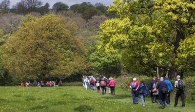
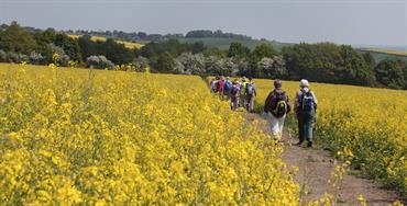
Starting from the source of the River Rother at Pilsley, the route passes through open farmland and the edges of woodland to reach and cross Roman Ryknild Street at Stretton.
Descending into the upper reaches of the Amber valley, more open farmland paths lead to the southern entrance to the mile long Clay Cross Tunnel which passes under the town of Clay Cross.
Passing over the end of the tunnel the route turns westward to skirt the edge of Old Tupton to reach Woodthorpe Hall. Turning south the route now passes through a section of woodland before returning to field paths to reach the northern edge of Clay Cross. A section of urban walking provides passage through the town before returning to farmland paths for the return to Pilsley.
Booking essential
Find us on whatthreewords - ///alienated.petted.cascade
Grid reference – SK 42409 62290
This is a circular walk
Bring a packed lunch
Organised by CNEDRA Chesterfield and North East Derbyshire Ramblers Association
Guide Prices
Booking essential. Free of charge, however, donations to the Mountain Rescue and Air Ambulance gratefully received.
Facilities
Children
- Children welcome - Under 16s must be accompanied by an adult, not recommended for children under 11yrs.
Property Facilities
- Dogs Accepted - Dogs must be on a lead
Routes
- Accessibility of route - Moderate
- Description of route - Circular walk, 11+ stiles, 3 rest stops, bring a packed lunch
- Length of route (miles) - 9½ miles
- Typical duration of route - 6 hours
Opening Times
| Season (18 May 2024) | ||
|---|---|---|
| Day | Times | |
| Saturday | 10:00 | |
* Walks will start promptly.
Map & Directions
Public Transport Directions
Nearest train station Alfreton, 6.5 miles away
Accesible by bus number 55