Archaeological Way
Type:Walking Route
3 Whaley Road
Langwith
Bolsover
Derbyshire
NG20 9HS
About
The Archaeological Way is a route that will run from Pleasley Pit Country Park to Creswell Crags. It is being developed for walkers, wheelchair users, pushchairs, cyclists and horse riders (where possible) to safely enjoy and explore the area. The first section, which is now open, runs four and a half miles from Shirebrook Wood to Poulter Country Park.
Travel the Archaeological Way and you'll be walking in the footsteps of history through a changing limestone landscape. The underlying geology of Permian Magnesian Limestone has helped create the landscape you see today. Grasslands, farmland and woodlands are crossed by small streams which carved gorges and vales, such as Creswell Crags and Pleasley Vale. Disused railway lines and old colliery sites are transformed into trails and country parks. Shirebrook Wood, Poulter and Pleasley Pit country parks are now havens for wildlife.
The Archaeological Way is a wildlife spotter's delight. Small mammals, insects and birds use the trails as wildlife corridors. If you're lucky you may spot a stoat or weasel hunting along the hedgerows. Listen for the call of skylarks over the meadows or the the green woodpecker in the woodland. Look out for carpets of wildflowers; you may see cowslips, yellow rattle and wild orchids in the grasslands or catch the scent of bluebells, wood anemones and ramsons (wild garlic) through the woodlands in spring.
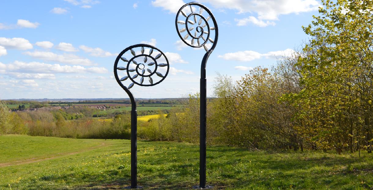
We've worked with artists and communities to develop artworks along the way that complement and enhance the landscape. You can't miss the large fern sculpture at Poulter Country Park, but there's also another installation as you cross the bridge over the A623, and a mural in Pleasley painted by students from Anthony Bek School. Look out for other pieces on the Way.
Scroll down the page for a leaflet and route map.
Download the Archaeological Way app from the App Store or Google Play.
Facilities
Accessibility
- Disabled access
Catering
- Picnic site
Children
- Children welcome
Parking
- Free Parking
Property Facilities
- Dogs Accepted - Please keep dogs on a lead
Routes
- Accessibility of route - Accessible for wheelchairs and pushchairs
- Length of route (miles) - 4½ miles (to be extended to 11 miles)
TripAdvisor
Map & Directions
Road Directions
From North/South Leave M1 at junction 29A and follow brown signs to Bolsover Castle. On reaching A632 follow road for approx 1 mile and, at roundabout, take 2nd exit (A632). Follow road for just under a mile into Bolsover. Pass right turn to Castle and continue on A632 for approx 1¼ miles through Bolsover and Hillstown to staggered crossroads. Turn left and immediately right and follow road for approx 2¼ miles to Derbyshire Pony Trekking. Continue on A632 for approx ½ mile and turn left onto Whaley Road. Follow road for approx 450 yards and Poulter Country Park car park on right.
From East Follow A617 to junction with M1 motorway. At roundabout take 4th exit (M1 North). Leave M1 at next junction (29A), then follow route from North/South.
From West Follow A619 to Chesterfield. At traffic light controlled roundabout (Matalan) select middle lane and take 3rd exit. Keep in left lane and, at traffic lights go straight on. At roundabout select middle lane and take 2nd exit (A632). Follow road, going straight on at traffic lights, for about 1 mile and, at traffic lights (Royal Hospital) go straight on. Follow road, going straight on at mini roundabout, for approx 1¼ miles to traffic lights and go straight on. At roundabout take 3rd exit (A632). Follow road for just under a mile into Bolsover then follow route from North/South.
Public Transport Directions
Nearest train station Langwith Whaley Thorns around 1 mile away
Bus number 82 from Chesterfield town centre, one per hour
.png)


