Carr Vale Flash Nature Reserve
Type:Nature Reserve
Bolsover
Derbyshire
S44 6GA
About
Carr Vale Nature Reserve is owned and managed by the Derbyshire Wildlife Trust and is the best wetlands site in the East Midlands for birdwatching.
It can be accessed from the Stockley Trail or from the Peter Fidler Nature Reserve which is next to it, and parking is available in the Stockley Trail car park off Riverside Way. The Doe Lea river runs through the site where the endangered water vole and even an occasional king fisher can be seen.
Carr Vale lies on a flyway for many species and great skeins of geese can be seen flying over during the winter months. In spring and autumn a range of migrating birds feed and roost here and, in early summer the marsh and scrub are home to a variety of breeding birds, including reed and sedge warblers, whitethroat, yellowhammer, and gadwall, and the grassland provides nesting habitat for the nationally declining skylark.
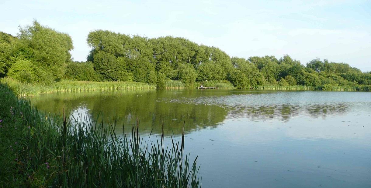
A network of footpaths makes the whole reserve accessible to the public and they’re great for wheelchair users. A series of small reed fringed lakes or ‘flashes’ stretch out in the bottom of the valley, and give the Reserve its name. Bolsover Castle and the dramatic ruin of Sutton Scarsdale Hall can both be seen from the Reserve
A footpath alongside the river takes you over the Millennium Bridge to a smaller pond and what is known locally as the ‘Southern Marsh’. The surrounding grasslands provide grazing for sheep, leading to short grass that’s great for breeding Lapwings and wintering Wigeon.
Facilities
Accessibility
- Disabled access
Catering
- Picnic site
Parking
- Free Parking
Property Facilities
- Dogs Accepted
TripAdvisor
Map & Directions
Road Directions
From North/South Leave M1 motorway at junction 29A and follow signs towards Bolsover on A632. From roundabout onto A32, follow road for just over ½ mile and, at roundabout, take 3rd exit onto Riverside Way. Follow road to car park at end.
From East Follow A617 to junction with M1 motorway. At roundabout take 4th exit (M1 North). Leave M1 at next junction (29A), then follow route from North/South.
From West Follow A619 to Chesterfield. At traffic light controlled roundabout (Matalan) select middle lane and take 3rd exit. Keep in left lane and, at traffic lights go straight on. At roundabout select middle lane and take 2nd exit (A632). Follow road, going straight on at traffic lights, for about 1 mile and, at traffic lights (Royal Hospital) go straight on. Follow road for approx 1¼ miles to traffic lights and go straight on. At roundabout take 2nd exit (A632). Follow road for approx 2¼ miles and, at roundabout take 3rd exit (Riverside Way). Follow road to car park at end.
Public Transport Directions
Nearest train station Chesterfield, 5 miles away
Bus number 82 or 83 from Chesterfield town centre, both run once per hour
.png)


