Trans Pennine Trail Southern Spur
Type:Walking Route
Corporation Street
Chesterfield
Derbyshire
S40 7UB
About
The southern spur of the Trans Pennine Trail runs from Chesterfield to Rother Valley Country Park.
The Trans Pennine Trail cross the country from Hull to Southport. The section from the cross country route between Chesterfield and Rother Valley Country Park is known as the southern spur and is 11 miles long.
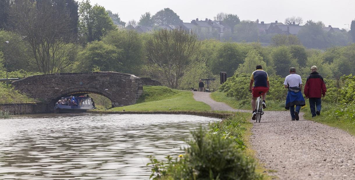
The Trail is a muti-user route suitable for walkers and cyclists, and almost all the southern spur is great for horse riders too. It’s also has generally gentle gradients and robust surfaces to is accessible to wheelchair users.
There is private parking at the Railway Station, or parking in any town centre car park in Chesterfield.
Part of the route, from Chesterfield to Staveley is divided. You can follow the Trans Pennine Trail route through Brimington Common, or cyclists and walkers can choose to follow the Cuckoo Way, the route along the Chesterfield Canal towpath. The two trails come together at Staveley and continue to Rother Valley Country Park. Scroll down the page for a map of the route.
There are many footpath links along the way taking you to attractions such as the ‘Crooked Spire’ Church, Revolution House, Bluebank Pools and Brearley Wetlands Local Nature Reserves, Barrow Hill Roundhouse Railway Centre and Renishaw Hall and Gardens. You can put together your own circular route or follow our ‘Hustle and Bustle to Birds and Bluebells’ route. Scroll down the page to download it.
Guide Prices
Free entry
Facilities
Accessibility
- Disabled access
Catering
- On-site catering
- On-site light refreshments
- Picnic site
Children
- Children welcome
Parking
- Free Parking
- Parking with charge
Property Facilities
- Dogs Accepted - Please keep dogs on a lead
- Public toilets
Routes
- Accessibility of route - Much of the route is wheelchair friendly, especially Bluebank Pools
- Length of route (miles) - 11 miles
TripAdvisor
Map & Directions
Road Directions
There is private parking at the Railway Station or at Brimington Road and the directions below are to the Station. Parking is available a short walk away on Durrant Road or at St Mary’s Gate.
From North/South Leave M1 at junction 29 and follow A617 to Chesterfield (approx 4 miles). At traffic light controlled roundabout select left lane and take 3rd exit. At next roundabout select right lane and take 2nd exit (Lordsmill Street). Keep in right lane and, at traffic lights go straight on. Follow road round Crooked Spire Church and, at traffic lights select right lane and go straight on. At next traffic lights select right lane follow signs to Sheffield Road and Station round roundabout. Exit down Brewery Street and follow road to roundabout. Go straight on to railway station.
From East Follow A617 to junction with M1 motorway, then follow route from North/South.
From West Follow A619 to Chesterfield. At traffic light controlled roundabout (Matalan) select middle lane and take 2nd exit turning left into Rutland Road. Select right hand lane at traffic lights at top of hill and turn right. Follow road to roundabout with car park in middle. Select right hand lane and take 3rd exit down Brewery Street (signposted for Station). Follow road to roundabout and go straight on to railway station.
.png)


